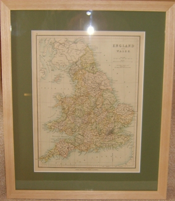
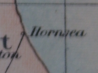
Yes, I know "new antique" os an oxymoron, but I didn't have it a couple of weeks ago so it's new to me. This one is from 1850 rather than the usual 1869, but I liked the fact that it had my home town on it:
You'll also notice that it's not of Europe, it's of England and Wales, so that's another departure from the norm. Well, it would appear that way, but ha! It has a secret!
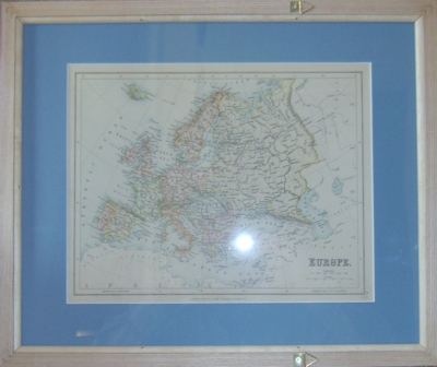
A lot of these maps from the mid-1800s come out of schoolbooks. Sometimes they have an article on the back that describes a country and its geography (often a different one to that depicted on the map), but if they came out of an atlas rather than a textbook then they usually show another map. This one does, and that was it. I had it framed to show both sides, although it's not entirely reversible because it needs rings to hang it up on. I got it put together so the England side will show, given that it was the England side that prompted me to buy the map in the first place.
I was thinking I might hang it on the wall of my office at the university, but I'll have to wait until my ghost roomie issue is resolved first.