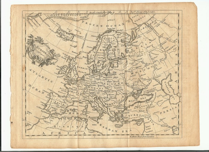
Old maps are great, because they show you not only how the world was, but how the world was thought to be. They're also a reminder that today's maps will look as familiar-yet-unfamiliar 250 years from now as maps from 250 years ago look to us today.
Here's a close-up of the map over the Bosphorus:
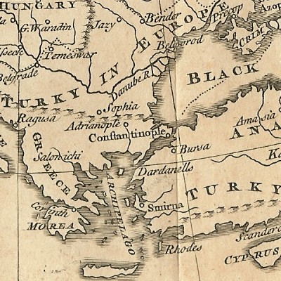
Istanbul is Constantinople, fair enough, but Turkey is Turky and it spreads up into modern-day Ukraine. Greece is a mere province of Turkey, and Athens doesn't even merit a mention (even though there's plenty of room for it).
This next close-up is of Scandinavia:
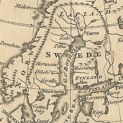
Sweden dominates the whole peninsula and what is now Finland. Finland itself is a mere area at the bottom part of its modern boundaries, lower in importance than Lapland and Norway (Norway was the junior partner in a union with Denmark at the time, and 50 years later would be ceded to Sweden). Looking at that map, you might think Lapland and Norway were the better bets to become independent countries, but Lapland didn't make it and Finland managed it instead. The to-be-capital of Norway, Oslo (at the time, Christiania) isn't shown, and neither is Finland's Helsinki/Helsingfors (although this is mainly because it only grew when Russia took Finland off Sweden in the early 1800s and set it up as a Grand Duchy buffer state).
Finally, here's one last close-up of Iceland:
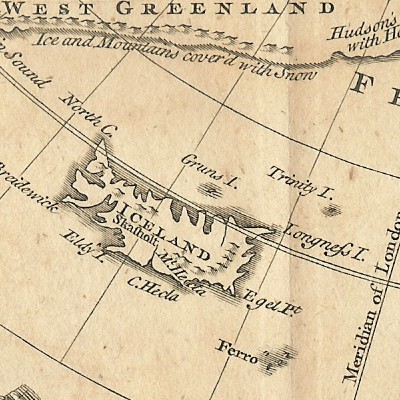
It only has one city, Skálholt. Normally, old maps have lots of cities in Iceland because there's lots of room to put them in the sea; from some, you'd think Iceland was more heavily-populated than France or Spain, it has so many cities. Here, though, we have just one — and it's not Reykjavik. This is because Skálholt was the seat of one of Iceland's two bishoprics at the time, which made it the country's cultural and political centre. Iceland itself was part of Norway (and therefore Denmark) at the time, so didn't have a real capital of its own.
The reason I thought I'd show that close-up, though, is because of the legend underneath Greenland: "Ice and Mountains cover'd with Snow". You don't get maps with that on them any more. Well, unless someone's done an overlay for Google Earth...