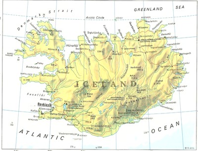
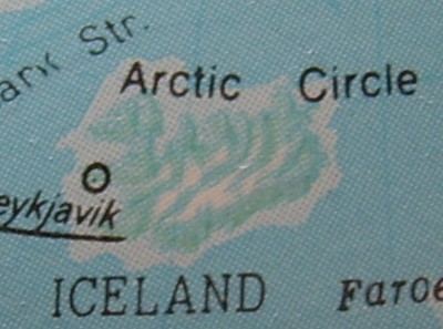
Most atlases use a Mercator projection, which projects a sphere onto a cylinder. This inevitably leads to som edistortion, which becomes more pronounced the further away the point is from the equator. Still, it's much better than an equirectangular projection, which makes Iceland look like this:
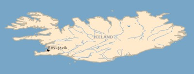
There's an argument that map projections are political tools to make countries seem more important to their inhabitants then they are geographically. This is why the Peters projection is sometimes advocated, as it maintains relative areas. It doesn't do Iceland many favours, though:

So what shape is Iceland? Well, we can tell easily enough by looking at a globe, albeit we need 3D vision to get a correct picture. I don't have a globe, but my mother has a cheapo one and this is what Iceland looks like on it (if I close one eye):
So it's like the Mercator projection, except not as far North/South. Taking a photograph of a globe from the normal to the surface is pretty much the same as taking a satellite image of the spot, and we do indeed see the same North/South shortening if we do that:
I don't know what this projection is called, and neither does Wikipedia. It's not a gnomonic projection, which rolls the surface out over the tangential plane in the same way that the Mercator projection rolls it out over the cylinder; it's close, however, to an orthographic projection (the azimothal equivalent of the equirectangular projection), except that it's not the view from from infinity.
Both the orthographic projection and the gnomonic one are as useless as the equirectangular projection when they cover large parts of the world, but for smaller, same-scale maps they're great! They have the same property that the Peters projection does, in that they preserve relative area, but they have the advantage of not distorting the shape much. This makes them a lot more useful to (finally, the point of this posting!) game designers.
I want an atlas of the world that splits the entire surface up into same-sized chunks with a satellite-style viewpoint, so I can create maps of anywhere I want. Better would be a digital globe that I can zoom in on to get the exact maps I want without having to composit parts centred elsewhere (eg. Greece centred on Greece, rather than Germany). Best of all would be the ability to make boards for board games that conformed to the shape of the Earth, so that a map of Europe would actually be a slice of a sphere rather than a flat surface, with pieces held on by magnets. Given my inability to get even simple card games manufactured, though, I realise this is something of an unrealistic goal.
I still want one of those atlases, though, I've just never seen one in the shops.
And don't get me started on how annoyed I was when flat screen monitors came out, as they reduced to rubble my plans to have a computer game with a map that conformed to the curve of the screen...